Geocode.xyz
Provides worldwide forward/reverse geocoding, batch geocoding and geoparsing.
About Geocode.xyz
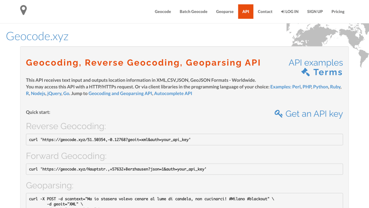
Geocode.xyz provides an API for forward geocoding, reverse geocoding, and geoparsing worldwide. Forward geocoding converts a place name or address into geographic coordinates, reverse geocoding converts a latitude/longitude point into a description of the nearest location, and geoparsing identifies and extracts place names from free-form text, returning all matched locations ordered by confidence score. The API also supports geolocating IP addresses and, in geoparsing mode, optional sentiment analysis on the submitted text.
Requests are made via HTTP/HTTPS, with input passed through parameters such as locate (for geocoding) or scantext (for geoparsing), and responses returned in XML, JSON, JSONp, GeoJSON, or CSV. Client libraries are available for Perl, PHP, Python, Ruby, R, Node.js, jQuery, and Go. Coordinates are expressed using the Web Mercator (WGS 84/Pseudo-Mercator) projection.
Unauthenticated requests are throttled to a combined rate of 1 request per second, while requests made with an API key allow up to 10 requests per second per key. Users needing higher throughput can run the software on their own server via an Amazon Cloud AMI.
Key features
- Forward geocoding of addresses, postal codes, and landmarks into latitude/longitude
- Reverse geocoding of latitude/longitude points into location descriptions
- Geoparsing to extract and geocode place names from free-text
- Sentiment analysis on geoparsed text
- IP address geolocation
- Output in XML, JSON, JSONp, GeoJSON, and CSV formats
Frequently asked questions
Is there a free tier?
Yes, unauthenticated requests are free but throttled to 1 request per second combined across all users.
What do I get with an API key?
An API key raises the rate limit to up to 10 requests per second per key.
What client libraries are available?
Client libraries are provided for Perl, PHP, Python, Ruby, R, Node.js, jQuery, and Go.
What data formats does the API return?
Responses can be returned in XML, JSON, JSONp, GeoJSON, or CSV format.
Can I run the geocoder on my own infrastructure?
Yes, an AMI is available to run the software on your own Amazon Cloud server without the throttling limits.


SerpApi - Search API
SerpApi's Search API makes it easy and fast to scrape Google and other search engines.

Show your product to thousands of developers
· 100k monthly pageviews
· 7k newsletter subscribers
You might also like
GeoApi
GeocodingFrench geographical data.
Geoapify
GeocodingForward and reverse geocoding, address autocomplete.
Geocod.io
GeocodingAddress geocoding / reverse geocoding in bulk.
Geocodify.com
GeocodingWorldwide geocoding, geoparsing and autocomplete for addresses.
GeoDataSource
GeocodingGeocoding of city name by using latitude and longitude coordinates.
GeoDescription
GeocodingReverse geocoding - Converting geographic coordinates to address-like location description.