GISTDA
Thailand natural disaster information.
About GISTDA
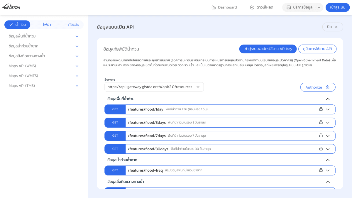
GISTDA's open API provides flood disaster data for Thailand, published by the country's space technology and geo-informatics agency as part of its open government data policy. It exposes flood-affected area data over rolling 1-day, 3-day, 7-day, and 30-day windows, along with recurring flood zone summaries and data on waterway obstructions such as water hyacinth. Data is returned in JSON format.
The API also offers mapping endpoints in WMS, WMTS, and TMS formats for the same flood and recurring-flood-zone datasets, allowing the data to be consumed as map tiles and layers in addition to raw feature data. Access requires logging in or registering for an API key, and documentation is provided.
This service is intended for developers and organizations building applications or systems that need spatial data on flooding and water obstruction in Thailand, such as disaster monitoring, mapping, or early-warning tools.
Key features
- Flood extent data for 1, 3, 7, and 30-day lookback periods via GET /features/flood endpoints
- Recurring flood area summary data via GET /features/flood-freq
- Water hyacinth (waterway obstruction) area data via GET /features/water_hyacinth
- Map imagery via WMS endpoints for flood and recurring flood areas
- Map imagery via WMTS tiled endpoints for flood and recurring flood areas
- Map imagery via TMS tiled endpoints ({z}/{x}/{y}) for flood and recurring flood areas
Frequently asked questions
What data format does this API use?
Data is published as JSON via REST endpoints, with additional map layers available as WMS, WMTS, and TMS.
Who provides this API?
It is provided by GISTDA (Geo-Informatics and Space Technology Development Agency), a Thai public organization, as part of the government's Open Government Data policy on disaster information.
How do I access the API?
Users must log in or register to obtain an API key, and a usage manual (คู่มือการใช้งาน API) is provided.
What is the base URL for the API?
The API is served from https://api-gateway.gistda.or.th/api/2.0/resources.
Who is this API for?
It is intended for the public and developers who need spatial flood and disaster-related data in Thailand.


SerpApi - Search API
SerpApi's Search API makes it easy and fast to scrape Google and other search engines.

Show your product to thousands of developers
· 100k monthly pageviews
· 7k newsletter subscribers
You might also like
Data Commons
WeatherOpen source initiative from Google. Global disaster events and statistics data.
Euskalmet
WeatherMeteorological data of the Basque Country.
Foreca
WeatherWeather.
GribStream
WeatherGlobal weather forecast API for any use. Leverage the NBM and GFS models. Great for bulk pulls.
Grill Index
WeatherScores grilling conditions 0–100 for any location: best cook window, week ahead, charcoal/gas/smoker tuning. No key needed.
HG Weather
WeatherProvides weather forecast data for cities in Brazil.