
Satellite Passes
Find satellite passes.
About Satellite Passes
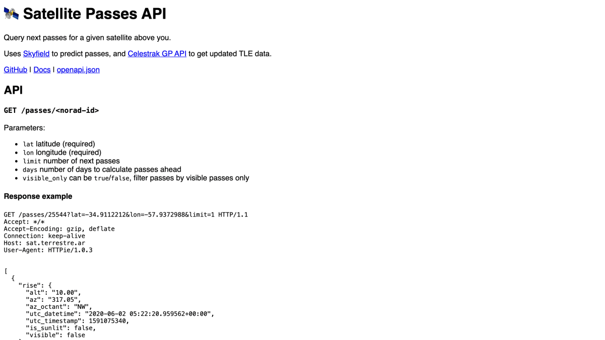
Satellite Passes is an API that predicts upcoming passes of a given satellite over a specified location. It accepts a NORAD ID along with latitude and longitude, and returns pass data including rise, culmination, and set times with altitude and azimuth values. It uses Skyfield for pass prediction and pulls updated TLE data from the Celestrak GP API.
The API supports optional parameters to limit the number of results, set how many days ahead to calculate, and filter for passes that are likely visible to an observer, based on the satellite being sunlit while the observer is in darkness near the horizon. Each response also indicates whether the satellite is sunlit at each point in the pass. Results are cached for one day per parameter combination, except when the limit parameter is varied.
This is aimed at developers building applications involving satellite tracking or visibility prediction, such as tools for observing objects like the ISS from a given location. Source code, documentation, and an OpenAPI specification are available.
Key features
- Predicts upcoming satellite passes for a given latitude/longitude using Skyfield
- Fetches updated TLE data from the Celestrak GP API
- Filter results to visible-only passes with the visible_only parameter
- Limit results by number of passes or number of days ahead
- Returns rise, culmination, and set details including altitude, azimuth, and sunlit/visibility status
Frequently asked questions
What data does the API return for a satellite pass?
For each pass it returns rise, culmination, and set events with altitude, azimuth, azimuth octant, UTC datetime/timestamp, sunlit status, and visibility.
Where does the satellite tracking data come from?
It uses Skyfield to predict passes and pulls updated TLE data from the Celestrak GP API.
Is there caching on the responses?
Yes, results are cached for 1 day per parameter combination, except when the limit parameter differs.


SerpApi - Search API
SerpApi's Search API makes it easy and fast to scrape Google and other search engines.

Show your product to thousands of developers
· 100k monthly pageviews
· 7k newsletter subscribers
You might also like
Numbers
Science & MathNumber of the day, random number, number facts and anything else you want to do with numbers.
Open Science Framework
Science & MathRepository and archive for study designs, research materials, data, manuscripts, etc.
Purple Air
Science & MathReal Time Air Quality Monitoring.
SHARE
Science & MathA free, open, dataset about research and scholarly activities.
SpaceX
Science & MathCompany, vehicle, launchpad and launch data.
Sunrise and Sunset
Science & MathSunset and sunrise times for a given latitude and longitude.